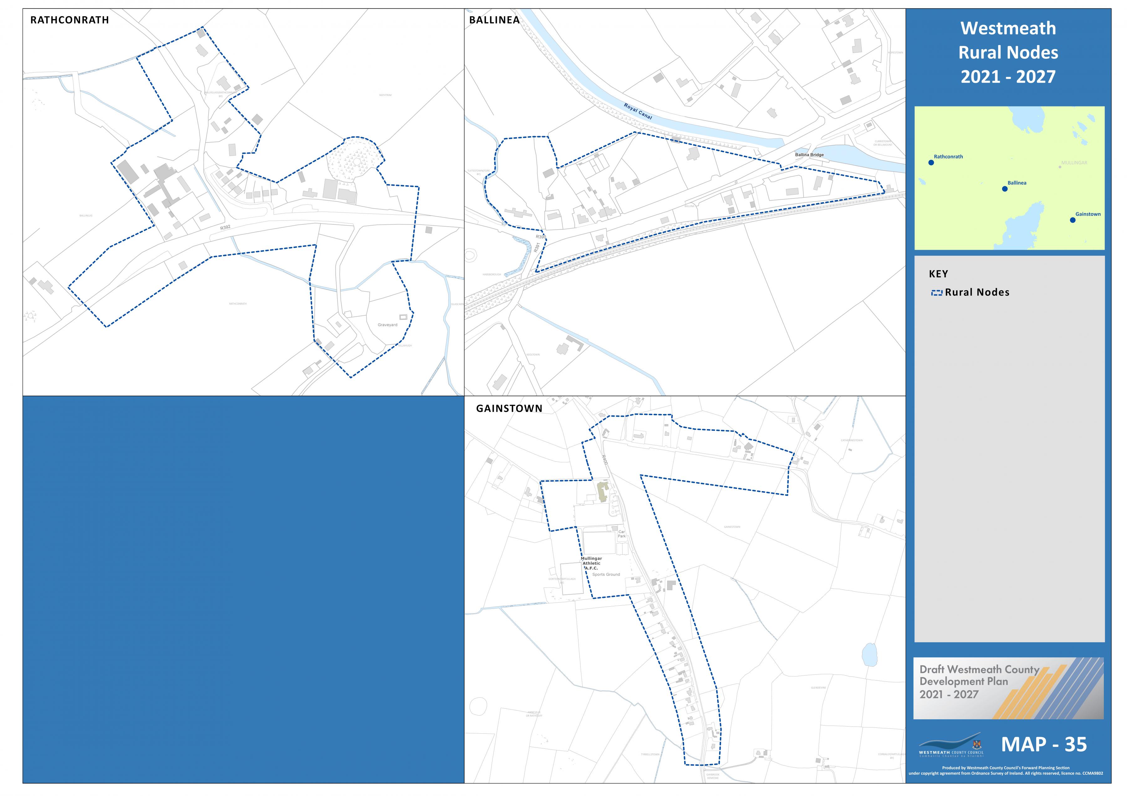
We formally request that the proposed Loughnavalley Rural Nodes Boundary to the western side of the village be extended to be in line with the Unserviced Settlemment Limits of the 2002-2008 Westmeath...
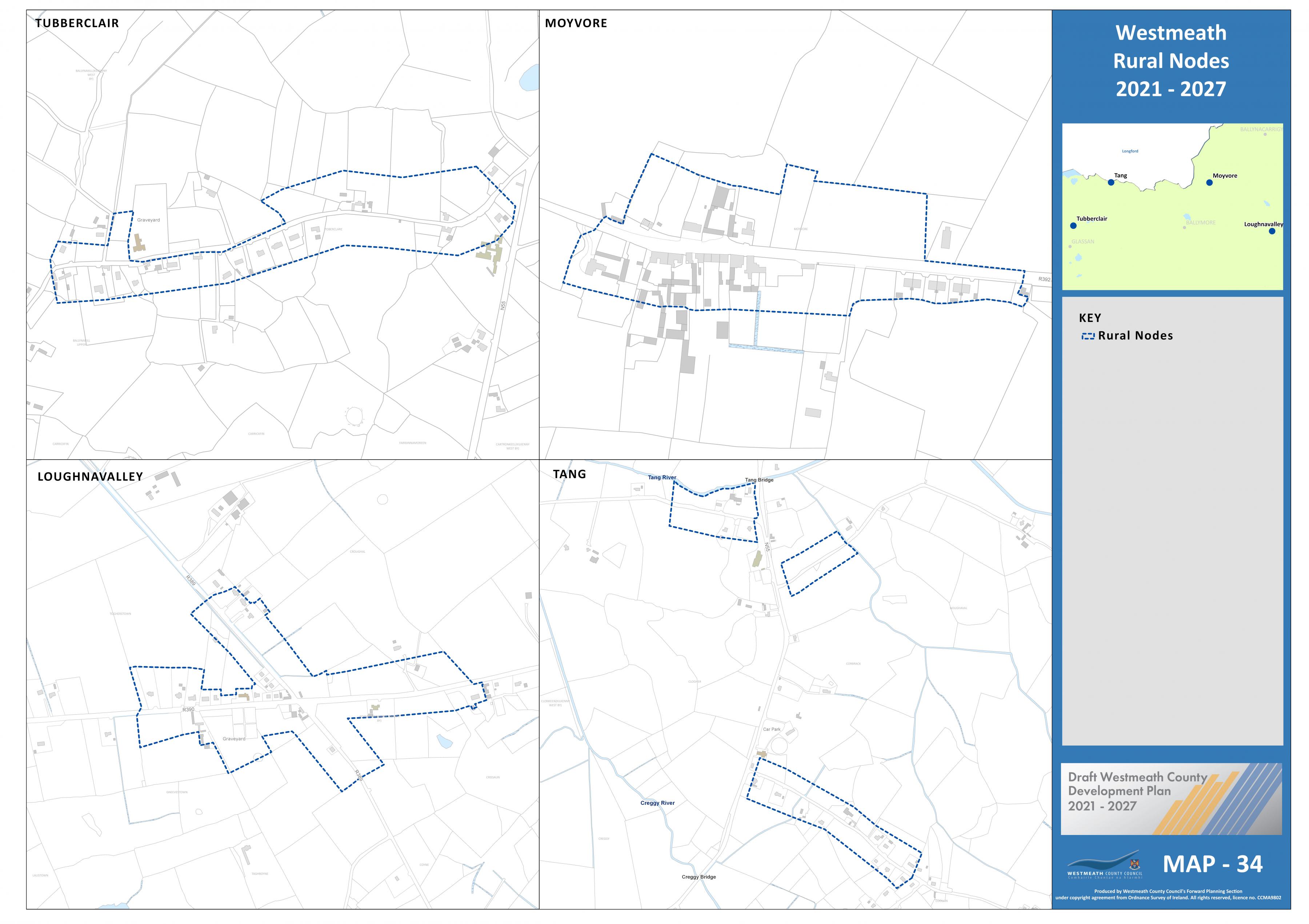
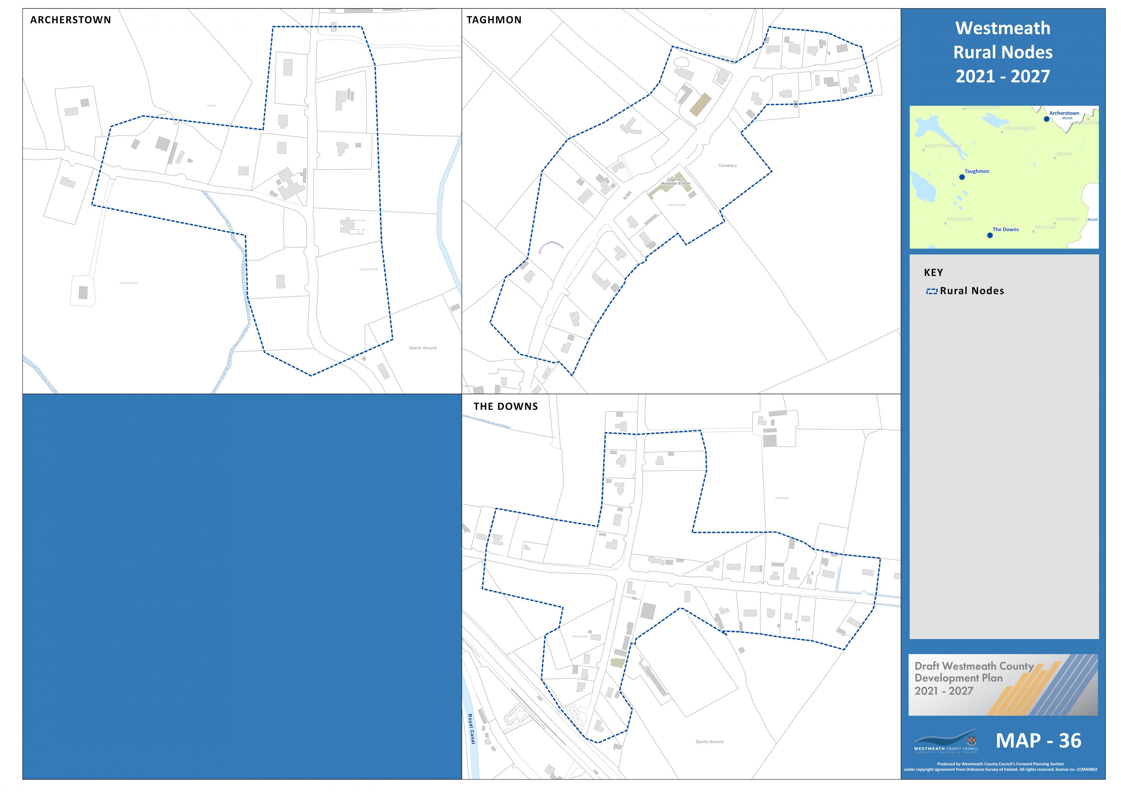
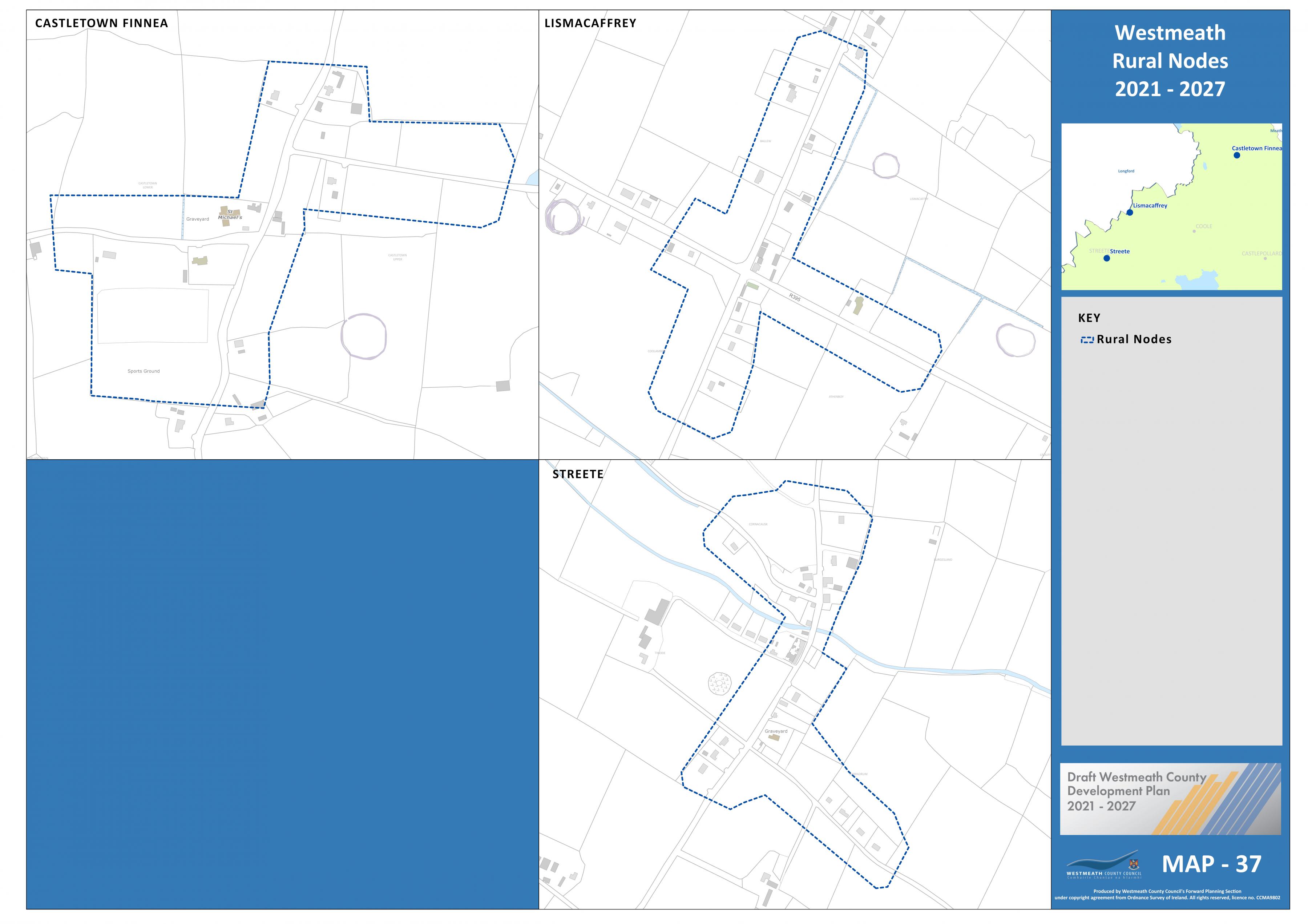
Maps 33-37: Rural Nodes
Dúnta28 Fea, 2020, 1:00pm - 30 Mei, 2020, 5:00pm
Map 33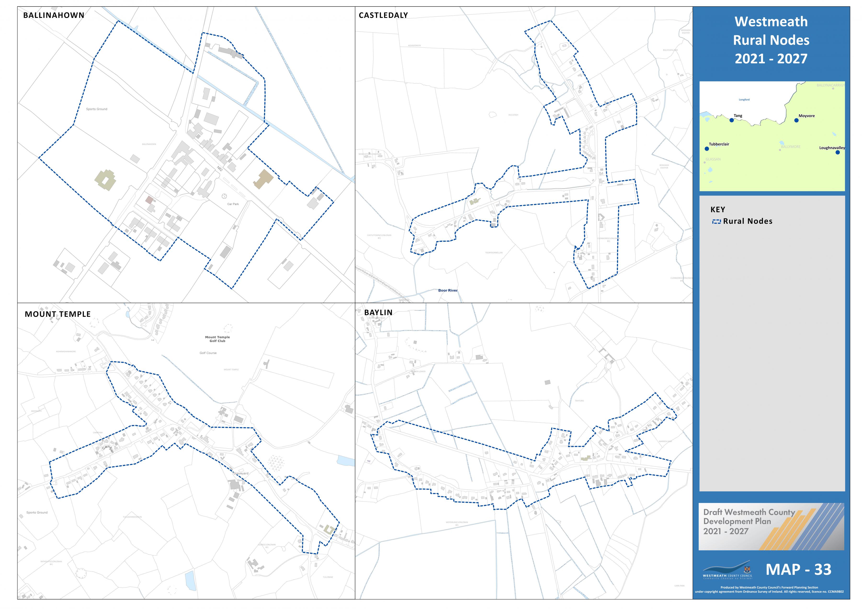
Map 34
Map 35
Map 36
Map 37
Clár ábhair
Ábhair
Tuairimí
Tuairimí
Submission from Loughnavalley Community Development Association re: Loughnavalley Settlement Boundary
Submission from James Mulligan re: Expansion of Residential Zoning in Loughnavalley
I own a small site in the heart of Loughnavalley (see attached map). Previousley this site was zoned residential and I applied for a small scheme of 15 houses. The Planner asked that I resubmit a...
Submission from Owen Cuskelly re: Zoning of lands at Loughnavalley for Community Water Treatment Facility
LOUGHNAVALLEY
Submission Re: ZONING Loughnavalley and Water Treatment Plant
Dear Sir/Madam,
Please find attached Sitemap showing...
Submission from Bernie Egan re: Request to zone lands for low scale residential development (see attached map) at Mount Temple, Co. Westmeath
Request to zone lands for low scale residential development (see attached map) at Mount Temple, Co. Westmeath
Submission from Stephan Groarke re: Zoning of Lands at Ballykeeran
Mr Stephan Groarke wishes to make a submission on the Draft Westmeath County Development Plan 2021-2027 in relation to his lands at Ballykeeran, Athlone, Co Westmeath.
It is considered that...